Top 10 Snowiest Cities in England
Most people who picture snowy England picture Manchester. Grey skies, northern grit, perpetual drizzle that turns to sleet. The assumption makes sense on the surface.
It’s also wrong.
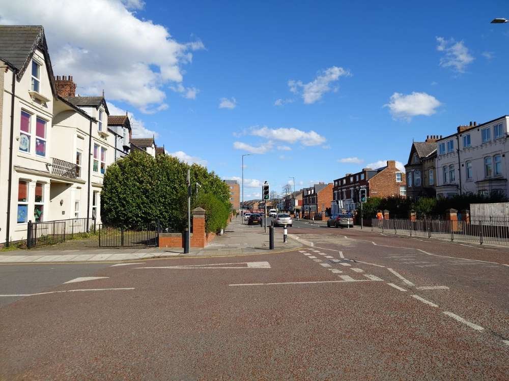
Manchester sits on the wrong side of the Pennines to get serious snow. The mountain range that runs up the spine of northern England acts as a barrier, blocking the cold easterly air masses that drive most of England’s significant snowfall events. Manchester gets the rain and the atmosphere. Sheffield, just 37 miles east, gets the snow.
The snowiest cities in England aren’t where you’d guess, and the list below makes that case with Met Office climate data rather than assumptions. Ranked by long-term annual snowfall averages, these are the English cities that see the heaviest and most consistent winter accumulation each year.
How We Ranked These Cities
England’s snowfall data works differently from what you’d see in a US or European context. The Met Office tracks both total annual snowfall in centimetres and the number of days with snow lying on the ground at 09:00 GMT, and both metrics matter for understanding how disruptive a city’s winter actually is.
A few things to know before you read the rankings. First, England is not a heavy-snowfall country by global standards. The snowiest English city on this list gets roughly as much snow per year as a mid-tier American city that doesn’t make any top-10 list. That context doesn’t diminish the disruption that snow causes here — England’s road infrastructure, school transport systems, and public attitudes toward winter weather mean that 10 centimetres shuts down a southern English city faster than a metre shuts down Marquette, Michigan.
Second, English snowfall varies more dramatically year to year than almost any other climate variable in the country. A mild winter can leave these cities nearly snow-free. A cold easterly pattern in February can dump 30 centimetres in 48 hours on cities that average 15 centimetres for the entire year. The averages smooth over an enormous amount of variation.
Third, cities with significant internal elevation variation, Sheffield being the clearest example, have city-centre figures that understate what large parts of the city actually experience. Where that matters, it’s noted in the city section.
10 Snowiest Cities in England
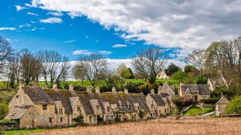
1. Sheffield, South Yorkshire
Sheffield’s position at the top of this list surprises people who didn’t grow up there. It surprises people who did, too, if they only know the city from the lower Don Valley where most visitors arrive. What makes Sheffield remarkable in the context of English snowfall is its geography — the city stretches from around 50 metres elevation on its eastern valley floor to over 500 metres on the Hallam Moors to the west. Those western areas sit on the edge of the Peak District and receive snowfall totals in a serious winter that would be considered significant anywhere in England.
The city’s recorded annual average across its primary weather station sits at approximately 50 centimetres per year, but that figure reflects the lower and middle areas of the city. Suburbs like Ranmoor, Fulwood, and Ringinglow at 200 to 350 metres elevation routinely record 20 to 40 percent more accumulation than the city centre in the same storm. A Sheffield resident’s experience of winter depends substantially on which part of Sheffield they live in.
What drives Sheffield’s snowfall is its position relative to easterly air flows. When cold anticyclonic air pushes in from Russia and Scandinavia, which happens several times in most English winters, it flows across the North Sea, picks up moisture, and hits the elevated eastern edge of the Pennines where Sheffield sits. The moors above the city are reliably among the first places in England to go white, and they’re among the last to clear.
School closures in Sheffield tend to happen more frequently than in most other English cities outside the Northeast. The combination of hilly road networks, where gradient combined with ice creates genuine bus safety concerns, and the elevated suburban areas that receive heavier accumulation means the city’s school administrators face more marginal closure decisions per winter than their counterparts in Leeds or Manchester.
Snow season: November through April
Peak months: January through February
Closure risk: High
2. Durham, County Durham
Durham’s claim to second place on this list is built on its position in the Northeast, its modest elevation on a sandstone ridge above the River Wear, and its exposure to the North Sea weather patterns that drive most of England’s serious snowfall events. The city itself sits at around 69 metres, not high by national standards, but far enough inland from the coast and far enough north to catch cold northeasterly air masses regularly.
County Durham as a county is one of England’s snowiest administrative areas. The Durham Dales to the west, Weardale and Teesdale, are among the most consistently snow-covered upland areas in the whole of England during winter. The city of Durham on the valley floor benefits from proximity to those weather patterns even if it doesn’t share the extreme upland totals. Annual snowfall for the city averages around 45 centimetres, with individual winters ranging from barely 10 centimetres in mild years to over 80 centimetres in a cold northeast winter.
The North Sea effect is the key mechanism here. When cold air pushes in from the north or northeast across the relatively unfrozen North Sea in early and mid winter, it picks up moisture over the water and deposits it as snow on the northeastern coast and inland areas of England. Durham is well-positioned to receive these events repeatedly through December, January, and February.
Durham has a university city character that creates a particular school and institutional closure culture. The university tends to continue operating through moderate snowfall, but the city’s schools and many public services are more cautious. Road conditions in the hills surrounding the city become dangerous before the city centre itself is seriously affected, which creates the same kind of graduated decision-making you see in Sheffield.
Snow season: November through April
Peak months: January through February
Closure risk: High
3. Bradford, West Yorkshire
Bradford sits slightly higher and further west than Leeds, and that combination of elevation and position relative to the Pennines earns it the third spot on this list. The city centre sits at around 130 metres, and its western suburbs extend toward the Pennine moorland, putting them in genuinely upland territory during significant snowfall events. Bradford’s annual snowfall averages approximately 45 centimetres, though the figure conceals considerable variation between city centre and moorland fringe neighbourhoods.
Bradford’s snowfall comes from two directions. Cold easterly air masses bring snow from the North Sea direction, just as they do for Sheffield and Durham. But Bradford is also close enough to the Pennine watershed to catch some snowfall from Atlantic low-pressure systems when they’re cold enough, which happens periodically in December and January. That dual exposure gives Bradford more potential snowfall windows than cities positioned firmly on one side of the Pennines.
The topography within Bradford creates road challenges similar to Sheffield. The city is built on deeply incised valleys separated by ridges, meaning the same snowfall event can leave main road arteries passable while residential streets on hillsides become effectively impassable. This is the geometry that drives school closure decisions more than accumulation totals in isolation. A 5-centimetre snowfall on flat roads is manageable. The same 5 centimetres on Bradford’s steeper residential streets at below-freezing temperatures is a different situation entirely.
Bradford doesn’t have the national profile that Sheffield or Newcastle do when winter weather discussions come up. It tends to get absorbed into broader “Yorkshire” snowfall coverage. But the data, and the experience of residents who have lived through a proper Bradford winter, tells you it belongs near the top of this ranking.
Snow season: November through March
Peak months: January through February
Closure risk: High
4. Leeds, West Yorkshire
Leeds and Bradford are separated by about 9 miles and sit in adjacent valleys, and their snowfall profiles are similar enough that the ordering between them depends heavily on which specific winter you’re measuring. Leeds averages around 40 centimetres annually, with its southern and western suburbs in higher terrain getting more and the city centre along the River Aire getting less.
Leeds International Airport, at approximately 208 metres elevation, records the official climate data most often referenced for the city. That elevated position means the published figures lean slightly snowier than what someone in the city centre would actually observe on the ground. But it also means the data captures what the elevated suburban areas of the city experience, and those areas represent a significant portion of the population.
January is Leeds’ peak month by most historical records. North Sea easterlies in January and February drive the most significant events, and the city’s position just east of the main Pennine watershed means it catches cold continental air without the full blocking effect that protects Manchester on the western side. Storm totals of 10 to 20 centimetres in a single 24-hour period happen most winters. Thirty centimetres happens in a big year.
Leeds school districts have developed a reasonably efficient system for responding to snowfall, partly because the city gets snow regularly enough that total unpreparedness would be untenable. School closure announcements in Leeds tend to follow a tiered approach: city centre schools often stay open when suburban schools at higher elevations close, reflecting the genuine difference in conditions within the same district.
Snow season: November through March
Peak months: January through February
Closure risk: Moderate-High
5. Harrogate, North Yorkshire
Harrogate sits at around 130 metres elevation on the southern edge of the Yorkshire Dales, and its position on the northern Yorkshire plateau gives it more consistent snow exposure than the bigger West Yorkshire cities directly to its south. Annual snowfall averages approximately 38 centimetres, but Harrogate’s winter character is less about dramatic totals and more about the frequency and persistence of snow cover during cold periods.
The Dales above Harrogate, Nidderdale and the Washburn Valley, are serious winter uplands. When cold air settles over the north of England, Harrogate sits at the southern edge of the zone where ground frost and snow lie continuously for days at a time, while Leeds and Sheffield, further south and in lower valleys, experience partial thaws between events. That persistence matters practically. A city that holds 10 centimetres for four days has more cumulative winter disruption than a city that receives 15 centimetres but thaws within 24 hours.
Harrogate is a prosperous spa town and conference centre, and its snow profile is probably less well-known than its Edwardian architecture and Betty’s tea rooms. But the residents who drive the elevated rural roads between Harrogate and Pateley Bridge or up toward Ramsgill in winter are well acquainted with what February in North Yorkshire actually looks like.
School closures in Harrogate tend to track closely with the wider North Yorkshire County Council responses to significant snowfall events. The council’s decision-making is influenced by rural school transport across the Dales, where roads become impassable before city schools have any reason to close.
Snow season: November through March
Peak months: January through February
Closure risk: Moderate-High
6. Newcastle upon Tyne, Tyne and Wear
Newcastle occupies the sixth position rather than somewhere higher on this list because its coastal position on the Tyne estuary gives it a relatively mild microclimate compared to inland cities at similar latitudes. The sea moderates temperature, which means precipitation that falls as snow a few miles inland often falls as rain or sleet in Newcastle city centre. Annual snowfall averages around 35 centimetres, but the variation within a single winter can swing dramatically.
What Newcastle does get, and gets reliably, is the North Sea snowfall effect when cold northeasterly air pushes in from Scandinavia. These events, sometimes called “haar snow” in the local vernacular (though haar technically refers to coastal fog), can bring 10 to 20 centimetres in a relatively short period, and the combination of cold coastal air with wet North Sea moisture makes for heavy, wet snow that compacts quickly under traffic and turns to ice overnight. It’s not the lightest snow to manage.
The Tyne bridges and elevated sections of the A1 are perennial problem spots during snowfall events. Newcastle’s city centre, built on steep slopes above the Tyne gorge, creates the familiar English challenge of a city where a small snowfall makes arterial routes manageable and residential streets treacherous simultaneously.
Newcastle has a pragmatic relationship with winter. It doesn’t panic at the first snowflake, unlike some southern cities, but it also doesn’t have the infrastructure of Scandinavian cities that allows winter to be absorbed entirely into normal operations. School closures happen in Newcastle, but they tend to be triggered by ice conditions and wind chill more than raw snow accumulation.
Snow season: November through March
Peak months: January through February
Closure risk: Moderate-High
7. Carlisle, Cumbria
Carlisle is England’s most northerly significant city, sitting just 10 miles south of the Scottish border, and its northern position earns it a place on this list despite being better known for flooding than snowfall. Annual snowfall averages around 33 centimetres in the city itself, with the surrounding Cumbrian fells and North Pennines recording substantially higher totals. The city sits in the Eden Valley, relatively low-lying, which moderates its snowfall compared to what the uplands on either side experience.
The Cross Fell plateau immediately east of Carlisle includes some of England’s snowiest terrain. Altitudes above 800 metres on the North Pennines regularly accumulate deep snow cover that persists from November through April in cold winters. Carlisle on the valley floor gets considerably less, but it catches the leading edge of snowfall events coming from both Atlantic westerly systems and cold northeasterly air masses, giving it a broad exposure window compared to cities sheltered by terrain.
Carlisle’s position on two major transport routes, the West Coast Main Line and the M6, makes its snowfall events nationally significant beyond just local disruption. When Carlisle gets serious snow, the rail and road connections between England and Scotland are affected in ways that show up in national news coverage rather than just local school closure announcements.
The city’s population is relatively small at around 75,000, which means the logistics of snow management feel different from a large metropolitan area. Road clearing resources cover a smaller area, but the distances between communities served by Carlisle’s schools can be substantial, particularly for rural catchment areas that feed into the city’s secondary schools from surrounding Cumbrian villages.
Snow season: November through April
Peak months: January through February
Closure risk: Moderate-High
8. Middlesbrough, Teesside
Middlesbrough sits between the Cleveland Hills to the south and the North Yorkshire Moors to the south and east, and that positioning exposes it to snow from multiple directions in a typical English winter. Annual snowfall for the urban area averages around 30 centimetres, with individual events driven primarily by North Sea easterlies that funnel cold air across the relatively flat Teesside plain.
The Cleveland Hills immediately south of the Teesside conurbation are seriously snowy uplands. Roseberry Topping and the Cleveland escarpment regularly accumulate significant snow cover while Middlesbrough’s town centre remains clear. That elevation gradient means that Middlesbrough school students catching buses from villages in the Cleveland Hills are navigating very different conditions from students who walk to school in the town centre, creating the kind of differential that makes school closure decisions genuinely difficult.
Middlesbrough’s industrial heritage and geographical character — a flat, wide estuary town — means snow accumulation looks and behaves differently from the hilly cities above it on this list. Without elevation change to trap cold air, snow events in Middlesbrough tend to arrive quickly, accumulate on flat surfaces without drifting patterns, and clear more quickly when temperatures rise. The total centimetres can match Sheffield but the experience is different.
North Sea streamers, the linear snowfall bands that form when cold air moves across open water and picks up moisture, can set up directly over Teesside in the right wind direction. When that happens, Middlesbrough can receive 10 to 15 centimetres in a few hours while areas 30 miles inland get nothing.
Snow season: November through March
Peak months: January through February
Closure risk: Moderate
9. York, North Yorkshire
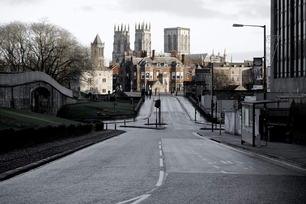
York sits in the Vale of York, a broad, flat plain between the Pennines to the west and the Yorkshire Moors and Wolds to the north and east. The city’s elevation is only about 17 metres above sea level, and this low position means it doesn’t get snow from elevation the way Sheffield or Bradford do. What it does get is exposure from two directions: cold westerly spill from the Pennines when storms are cold enough to snow down to low levels, and northeasterly North Sea events that track across the flat Vale directly toward the city.
Annual snowfall in York averages around 28 centimetres. In a cold continental winter, North Sea cold air can set up over the Vale of York and deliver repeated modest snowfall events over several days that accumulate into significant totals. In a mild maritime winter, York can go from December to March with nothing more than a few brief flurries.
York’s flat topography makes road clearance more straightforward than in the hilly cities further up this list. The A64, A19, and the city ring road can be kept open during moderate snowfall events that would close residential streets in Sheffield. This easier road management means school closures in York are less frequent than the annual snowfall total alone might suggest.
York is a major heritage tourist destination, and snowfall in the city generates the kind of picturesque social media content around York Minster and the Shambles that northern cities routinely experience. That visibility makes York’s snowfall feel nationally significant in years when conditions are photogenic, even when the actual accumulation is modest.
Snow season: November through March
Peak months: January through February
Closure risk: Moderate
10. Sunderland, Tyne and Wear
Sunderland closes the list as one of the Northeast’s coastal cities with consistent if not dramatic snowfall. Its position on the coast, directly facing the North Sea, means cold northeasterly air masses hit Sunderland without significant inland buffering. Annual snowfall averages around 25 centimetres, lower than the inland northeast cities but delivered in a distinctively coastal pattern — shorter events, heavier snow rates, rapid change as bands set up and move.
The coastal geography means Sunderland’s snowfall is often event-driven rather than gradual. A North Sea polar maritime air mass in February can bring 10 centimetres in under 12 hours, then move on. Road surfaces can go from dry to dangerously icy to partially clear within the same day, which creates decision-making challenges that prolonged inland snowfall events don’t present in the same way.
Inland Sunderland and the western neighbourhoods toward Washington and Houghton-le-Spring are both slightly higher in elevation and slightly further from the coastal moderating effect, meaning they can record noticeably more snow than the seafront areas during significant events. Like most cities on this list, the snow experience is not uniform across postcodes.
Sunderland’s school closure patterns track closely with broader Tyne and Wear responses to weather events. The area has a compact road network with fewer of the extreme gradient challenges seen in South Yorkshire, so closures tend to be driven by the severity of individual events rather than the cumulative effect of persistent ground cover.
Snow season: November through March
Peak months: January through February
Closure risk: Moderate
England’s Snowiest Cities — Comparison Table
| # | City | Annual Avg | Peak | Season | Risk |
|---|---|---|---|---|---|
| 1 | Sheffield | ~50 cm / 20″ | Jan–Feb | Nov–Apr | High |
| 2 | Durham | ~45 cm / 18″ | Jan–Feb | Nov–Apr | High |
| 3 | Bradford | ~45 cm / 18″ | Jan–Feb | Nov–Mar | High |
| 4 | Leeds | ~40 cm / 16″ | January | Nov–Mar | Mod-High |
| 5 | Harrogate | ~38 cm / 15″ | Jan–Feb | Nov–Mar | Mod-High |
| 6 | Newcastle | ~35 cm / 14″ | Jan–Feb | Nov–Mar | Mod-High |
| 7 | Carlisle | ~33 cm / 13″ | Jan–Feb | Nov–Apr | Mod-High |
| 8 | Middlesbrough | ~30 cm / 12″ | Jan–Feb | Nov–Mar | Moderate |
| 9 | York | ~28 cm / 11″ | January | Nov–Mar | Moderate |
| 10 | Sunderland | ~25 cm / 10″ | January | Nov–Mar | Moderate |
How England’s Snowfall Compares to the Rest of the World
England’s snowfall figures on this list are modest by global standards, and it’s worth being honest about that. Sheffield at the top of the table with approximately 50 centimetres per year would sit somewhere in the middle of a European snowfall ranking, below Oslo, Helsinki, Tromsø, and every Alpine city. Against US cities, the comparison is even more stark — the snowiest cities in the US begin where England ends.
What England does have is a built environment, transport network, and institutional culture that makes even modest snowfall genuinely disruptive. The same amount of snow that a Finnish city absorbs without comment sends an English one into emergency mode. That’s not a criticism — it’s a reflection of rational infrastructure investment decisions in a country where heavy snow is infrequent rather than routine.
If you’re trying to predict a school closure in a US or Canadian city ahead of a winter storm, the snow day predictor uses real-time National Weather Service data to give you a probability based on your specific ZIP or postal code.
FAQ’s
Sheffield is consistently ranked among England’s snowiest cities due to its position on the eastern edge of the Pennines and significant internal elevation variation. Parts of Sheffield’s western suburbs receive more snow per year than any other urban area in England south of the Scottish border. Durham and Bradford are the other cities most frequently in contention for the top position depending on the specific winter.
Northern cities, particularly those with elevated western suburbs exposed to Pennine weather, typically see the first snowfall of the season. Sheffield’s high moorland areas, the Dales above Harrogate, and the uplands above Bradford can all record significant snowfall from October onward in cold years. City centres typically see their first snow in November or December.
London averages around 5 centimetres of snow per year, spread across roughly 4 to 7 days of snowfall. Heavy snowfall in the capital is rare. The Southeast’s position near the Atlantic and relatively low elevation means most winter precipitation falls as rain, and when snow does arrive it typically melts within 24 to 48 hours. The “Beast from the East” in 2018 was a notable exception, bringing 20 to 25 centimetres to parts of Greater London over several days.
The Pennines act as a natural barrier between the western maritime climate (rain) and the eastern continental climate (snow and cold). Manchester sits on the western, Atlantic-facing side of the Pennines, where winter precipitation falls predominantly as rain. Sheffield sits on the eastern side, where cold northeasterly air masses from Russia and Scandinavia deliver snow without the warming barrier of the Atlantic. The two cities are separated by about 37 miles, but they’re in fundamentally different winter climate zones.
The winter of 1947 is the most severe on record across England, with continuous snowfall and frost from late January through mid-March. Depths of over a metre were recorded in parts of northern England, and many communities were cut off for weeks. More recently, January 2010 brought the coldest UK winter in 30 years, and the March 2018 “Beast from the East” brought rapid, significant snowfall across England including unusual amounts for normally mild southern areas.
England averages between 15 and 30 days of snow or sleet falling per year across the northern regions, dropping to 3 to 7 days in the South and around London. Days of snow actually lying on the ground (the more disruptive measure) range from around 20 to 30 in northern upland areas to fewer than 5 in the South. These figures vary enormously year to year.
Cities in southwest England and along the south coast, including Plymouth, Exeter, Bournemouth, and Brighton, average 2 to 4 days of snowfall per year and rarely see snow lying on the ground for more than a day or two. The mild oceanic influence of the English Channel and the Southwest Approaches keeps temperatures above the snow threshold in most winters. Cornwall occasionally records no meaningful snowfall at all.