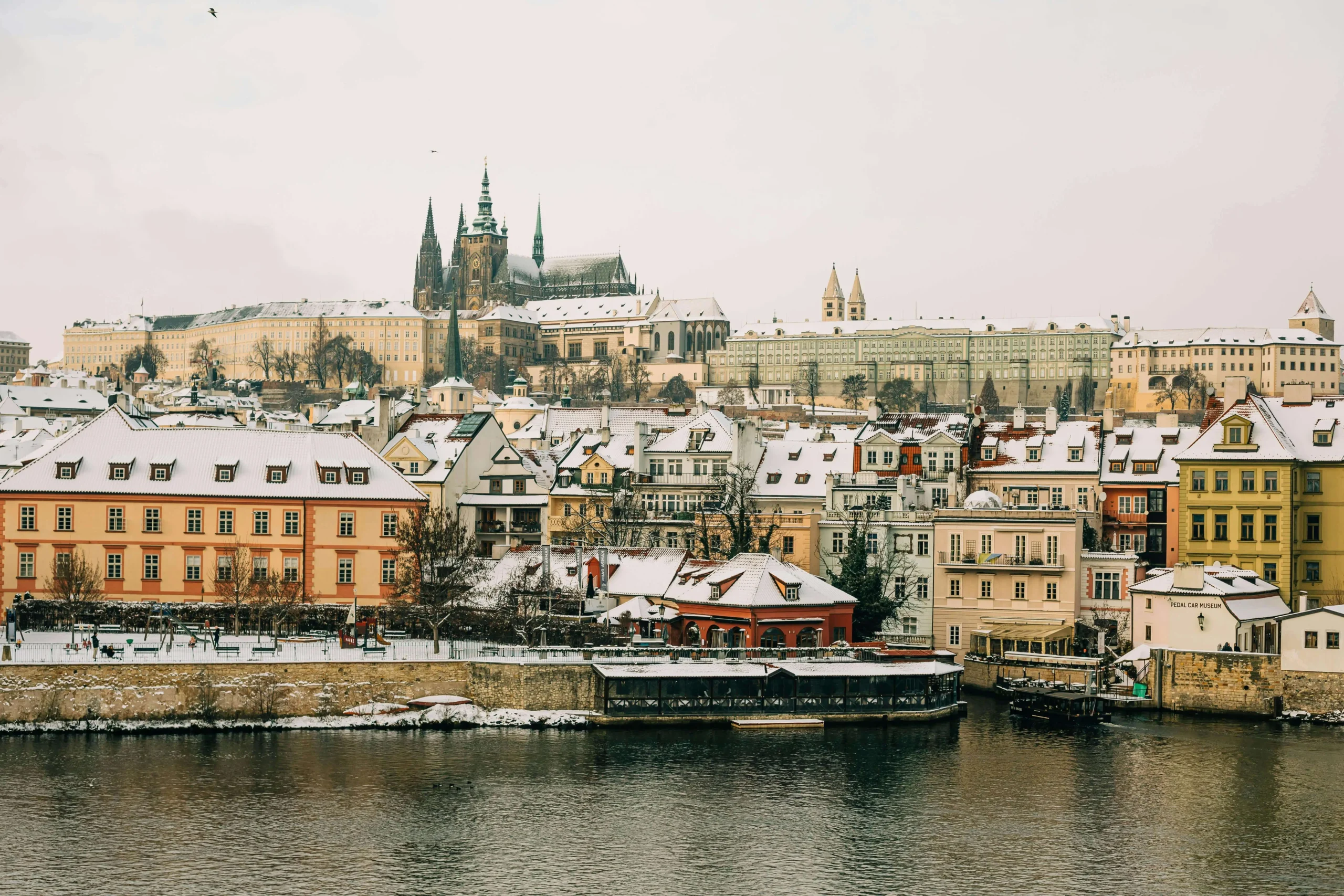
Top 10 Snowiest Cities in Europe Ranked by Annual Snowfall Data
The snowiest city in Europe isn’t in the Alps. It isn’t in Norway’s famous ski regions or Iceland’s volcanic landscape. It’s in Russia, above the Arctic Circle, on a coastline most people couldn’t find on a map without help.
That’s where the data goes if you follow it instead of assumption.
This list ranks the 10 snowiest cities in Europe by annual snowfall accumulation, not snow day count, not seasonal averages smoothed into something comfortable. Total centimetres of snow that actually falls on these cities, averaged across decades of meteorological records. If you’ve ever wondered which European cities genuinely get buried every winter and which ones just have a reputation for it, this is the breakdown.
All figures come from long-term climate averages compiled by European national weather agencies. Town and city station data only, not mountain summit readings.
- How We Ranked These Cities
- The 10 Snowiest Cities in Europe
- 1) Murmansk, Russia
- 2) Innsbruck, Austria
- 3. Tromsø, Norway
- 4. Sarajevo, Bosnia and Herzegovina
- 5. Oslo, Norway
- 6. Helsinki, Finland
- 7. Stockholm, Sweden
- 8. Bern, Switzerland
- 9. Reykjavik, Iceland
- 10. Warsaw, Poland
- Europe Snowfall Comparison Table (All 10 Cities)
- How Do European Snow Days Compare to the US?
- FAQ’s
- What is the snowiest city in Europe?+
- What is the snowiest European capital city?+
- Which European city gets snow the earliest in the year?+
- Does it snow in Reykjavik?+
- Which European city is best to visit for a snowy winter experience?+
- How does European snowfall compare to the snowiest US cities?+
- What month gets the most snow in European cities?+
How We Ranked These Cities
Annual snowfall accumulation is the most useful single measure of how snowy a city actually is. It tells you what shows up on the ground, how much road crews have to move, and how quickly normal urban life gets disrupted.
A few clarifications on the method. Some alpine cities have weather stations at different elevations, and those readings can vary by 30 to 50 centimetres depending on which station you use. Where that variance exists, we’ve used the primary city-centre station, not the higher-elevation outlier. Similarly, cities with strong ocean influences, Reykjavik is the obvious example, have snowfall totals that look modest on paper because maritime air brings warmth alongside precipitation, causing frequent melt between events. The annual accumulation figure is still accurate; the ground experience is just different from a landlocked city at the same latitude.
One more thing: Murmansk sits at #1 by a significant margin. That gap isn’t a data error.
The 10 Snowiest Cities in Europe
1) Murmansk, Russia

Most conversations about Europe’s snowiest cities start somewhere in Norway or Austria. They should start here, 300 kilometres above the Arctic Circle on the Kola Peninsula, where Murmansk averages 280 centimetres of snow per year.
Murmansk is the world’s largest city north of the Arctic Circle, with a population around 300,000, and its winter is not the picturesque kind that ends up on travel posters. The snow arrives in October and doesn’t leave until May. Ground cover can exceed a metre during the deep winter months, and overnight accumulations of 15 to 25 centimetres are common enough that residents treat them as routine maintenance rather than events. The city operates normally through conditions that would shut down most of western Europe.
What makes Murmansk’s snowfall so extreme is a combination of latitude, Arctic moisture systems sweeping in from the Barents Sea, and the absence of the oceanic warming effect that softens winter for Norway’s coastal cities. The Gulf Stream loses much of its influence this far east. Cold air masses have a clear path from the Arctic interior to the Kola Peninsula coast, and they use it, repeatedly throughout the winter.
School closures in Murmansk happen on terms that would surprise most European parents. Extreme cold temperatures below -25°C combined with wind is a more common closure trigger than raw snowfall totals. The city’s infrastructure is built to handle 280 centimetres of annual snow. What it can’t fully buffer is sustained extreme cold, which is a different kind of disruption.
Snow season: October through May
Peak months: November through January
Closure risk: Very High
2) Innsbruck, Austria
Innsbruck is a city of 130,000 people sitting in a valley floor surrounded by the Alps on three sides, and that geography explains almost everything about why it gets 170 centimetres of snow per year.
The city itself sits at 574 metres elevation. The mountains directly above it reach 2,300 metres. That altitude difference creates an environment where snowfall mechanisms operate simultaneously at different levels of the atmosphere. Large synoptic storm systems bringing moisture from the Atlantic and Mediterranean converge with orographic lift from the mountain walls, compressing precipitation and dropping it heavily on the valley. When a significant storm tracks across Central Europe, Innsbruck doesn’t just catch the edge of it. It sits directly in the convergence zone.
The winter season in Innsbruck runs from November through April, with January and February producing the most sustained heavy accumulation. Ground snow depth can reach 60 to 80 centimetres in an active winter, and the surrounding mountain areas record significantly higher totals. The Nordkette range immediately north of the city routinely exceeds 400 centimetres in a season, though those are mountain station readings, not city data.
Innsbruck has hosted the Winter Olympics twice, in 1964 and 1976, and continues to compete in alpine winter sports infrastructure. The city is engineered for its winters in a way that few European capitals are. That doesn’t make closures impossible; it makes them rarer than the snowfall totals might suggest for a city less prepared for its own climate.
Snow season: November through April
Peak months: January through February
Closure risk: Very High
3. Tromsø, Norway
Tromsø sits at nearly 70 degrees north latitude, making it one of the northernmost cities of any meaningful size in the world. Its annual snowfall average of 150 centimetres reflects a climate shaped by Arctic systems pushing in from the Barents Sea, though the presence of the Gulf Stream along Norway’s coast prevents temperatures from dropping as low as inland Russian cities at the same latitude.
The snow season in Tromsø is long. The first measurable snowfall typically arrives in October. The last doesn’t clear until April, and in some years May sees late accumulation at the city’s higher elevations. January and February are the peak months in terms of both frequency and single-storm intensity. Events producing 20 to 30 centimetres over 48 hours happen multiple times per season, and blowing and drifting snow compounds the accumulation effect when Arctic winds reach sustained speeds.
Something that distinguishes Tromsø from the other Arctic cities on this list is how darkness interacts with snowfall. From late November through late January, Tromsø experiences polar night — the sun doesn’t rise above the horizon at all. Heavy snowfall in those conditions creates a navigation challenge that goes beyond road clearance. Infrastructure planning, school decisions, and daily commuting all happen under winter darkness combined with active snowfall, which is genuinely unlike anything most Europeans experience.
Despite the totals, Tromsø handles its winters with the efficiency you’d expect from a Norwegian city that has never known a mild one. School closures related to snowfall alone are uncommon. Wind and visibility are more likely to drive disruption than accumulation.
Snow season: October through April
Peak months: January through February
Closure risk: Very High
4. Sarajevo, Bosnia and Herzegovina
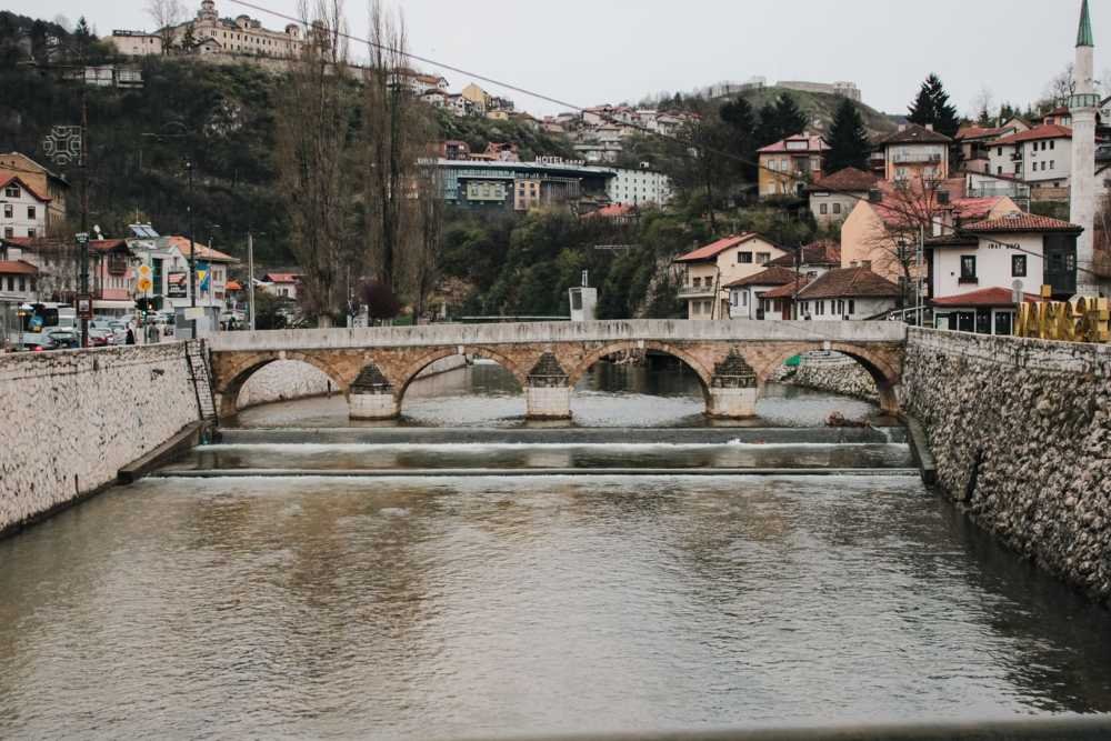
Sarajevo doesn’t always come up in European snowfall conversations, and that’s a mistake. The capital of Bosnia and Herzegovina sits in the Sarajevo valley, surrounded by the Dinaric Alps at around 500 metres elevation, and it averages 140 centimetres of snow per year. That figure puts it ahead of Oslo, Helsinki, Stockholm, and every other European capital except the ones higher on this list.
The 1984 Winter Olympics were held in Sarajevo. That fact alone should settle any doubt about whether the city gets serious winter weather. The surrounding Bjelašnica and Jahorina mountains receive some of the heaviest snowfall in the Balkans, and Sarajevo’s valley position captures weather systems pushing northeast from the Adriatic and south from Continental Europe. When those systems collide in the Dinaric range, the result is prolonged, heavy snowfall that can isolate mountain roads for days while the city centre manages more modest but still significant accumulation.
The freeze-refreeze cycle is a secondary factor in Sarajevo’s winters that visitors from Western Europe often underestimate. Temperatures in the valley floor swing more dramatically than in coastal cities, meaning that after a heavy snowfall, the melt-and-refreeze sequence creates ice layers that persist for days and make surfaces genuinely dangerous well after the snow itself has stopped.
School closure patterns in Bosnia follow stricter protocols than in more northern European countries, because the infrastructure for rapid snow clearance, particularly at scale, doesn’t match what Norwegian or Finnish cities maintain. A 20-centimetre snowfall that Tromsø absorbs without comment can push Sarajevo schools toward a late start or closure.
Snow season: November through March
Peak months: January through February
Closure risk: Very High
5. Oslo, Norway
Oslo is Norway’s capital and its most populated city, and with 130 centimetres of annual snowfall, it sits comfortably among Europe’s snowiest major cities. Oslo’s winter character is distinctly different from coastal Norwegian cities like Bergen, which receives dramatically less snow despite sitting at a similar latitude. Oslo is an eastern city in terms of its climate pattern it pulls weather from the Scandinavian interior, and that inland influence produces colder, drier, snowier conditions than the Atlantic-exposed west coast.
The city receives consistent snowfall from November through April, with January bringing the heaviest single-month totals on average. In active winters, Oslo’s streets carry a permanent layer of packed snow from December through February, and cross-country skiing routes through the city’s surrounding forests, the Marka, become some of the most used recreation infrastructure in any European capital. That’s not a tourism marketing claim. It’s a practical reflection of how reliably snowy the city is.
Oslo’s school closure approach reflects the Norwegian cultural framework around outdoor winter activity: get outside, dress appropriately, snow is not an excuse to stay home. Closures happen, but the bar is higher than in Central or Southern European cities. Extreme cold combined with wind, or ice-forming freezing rain, is more likely to trigger administrative decisions than straightforward snowfall, even at heavy rates.
The fjord geography around Oslo means that different parts of the city and its suburbs experience genuinely different amounts of snowfall depending on elevation and exposure. Eastern and elevated suburbs regularly record 20 to 30 percent more annual accumulation than the city centre stations.
Snow season: November through April
Peak months: January through February
Closure risk: High
6. Helsinki, Finland
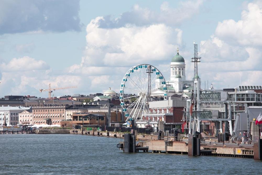
Helsinki averages 115 centimetres of annual snowfall, and Finnish winter has a particular quality that sets it apart from Scandinavian coastal cities. The Baltic Sea doesn’t provide the same warming buffer as the Atlantic-influenced Norwegian coastline. Helsinki’s winters are colder, its snow stays longer on the ground, and its season runs with remarkable consistency from November through April without the midwinter thaw events that disrupt cities further south.
Finnish school closure policy is famously strict about not closing for weather. Finnish children go to school in conditions that would cancel school in most other European countries without much discussion. The logic is straightforward: if you cancelled school every time Helsinki received meaningful snow, you’d lose a significant portion of the academic year. Schools are built for winter, bus routes are planned around it, and the expectation is that children in appropriate clothing can function in heavy snow and cold.
That said, temperature extremes do drive closures. Helsinki experiences sustained periods below -20°C in cold winters, and at those temperatures, outdoor exposure while walking to school or waiting for buses becomes a genuine health concern rather than just an inconvenience. Snowfall at -20°C also behaves differently from snowfall at -5°C, accumulating faster and compressing less under traffic, which affects road conditions more than the raw centimetre total suggests.
The Baltic’s position matters too. When sea ice forms on the Gulf of Finland, as it does in most winters, it removes the moderating water influence from Helsinki’s immediate environment and allows temperatures to drop more severely during clear-sky events.
Snow season: November through April
Peak months: January through February
Closure risk: High
7. Stockholm, Sweden

Stockholm sits at 59 degrees north latitude, roughly equivalent to Anchorage, Alaska, though its maritime proximity to the Baltic and its position within the Scandinavian peninsula gives it a milder winter than that comparison might suggest. Annual snowfall averages 80 centimetres, lower than the Nordic cities above it on this list but still substantial enough to define the city’s winter character completely.
The Swedish capital’s snowfall pattern is irregular in a way that distinguishes it from cities like Helsinki or Oslo. Stockholm can go several weeks in January with minimal accumulation, then receive 30 to 40 centimetres in a single event as a low-pressure system pulls moisture from the Baltic. That bursty, event-driven pattern means individual storms draw attention even when the seasonal total is lower than more consistently snowy cities further north.
December and January are Stockholm’s heaviest snow months, though March storms are common and can be among the season’s most significant because they combine remaining cold air with increasing atmospheric moisture. Late-season storms in March frequently produce heavier individual totals than the quieter midwinter months.
Stockholm’s urban snow management infrastructure is substantial. The city maintains hundreds of kilometres of designated winter road priority routes, and the subway system operates normally through any snowfall short of an extreme event. Closures in Stockholm schools are rare; the city is simply too experienced with winter to let manageable snowfall interrupt routine.
Snow season: November through March
Peak months: December through January
Closure risk: Moderate-High
8. Bern, Switzerland

Bern is the Swiss capital and sits at 540 metres elevation on the Swiss Plateau, positioned between the Bernese Alps to the south and the Jura mountains to the northwest. That position funnels winter systems into the city from multiple directions, producing an annual snowfall average of 70 centimetres that doesn’t fully communicate how alpine the winter experience actually is.
Switzerland’s geography means that even cities on the plateau sit close enough to major mountain terrain that weather systems interact with altitude throughout their passage. A storm that tracks across the Swiss Plateau loses moisture as it rises toward the Alps, but it dumps that moisture first, and Bern catches a significant share of it. Winter in Bern is cold enough that snow accumulates rather than melting between events, maintaining consistent ground cover from December through February in most years.
The Swiss approach to winter is deeply pragmatic. Bern’s streets are salted and ploughed efficiently, public transport continues through all but the most severe events, and school closures from snowfall alone are genuinely rare. The country’s infrastructure investment in managing alpine winter conditions extends to its lowland cities, which operate on the assumption that winter will arrive, stay for several months, and need to be worked around rather than reacted to.
What Bern gets from its mountain proximity is occasional heavy snow events driven by southerly Föhn winds interacting with Alpine barriers, conditions that can produce rapid, intense accumulation when weather patterns line up correctly. In those events, the plateau cities temporarily experience snowfall rates more typical of high-altitude alpine stations.
Snow season: December through March
Peak months: January through February
Closure risk: Moderate-High
9. Reykjavik, Iceland
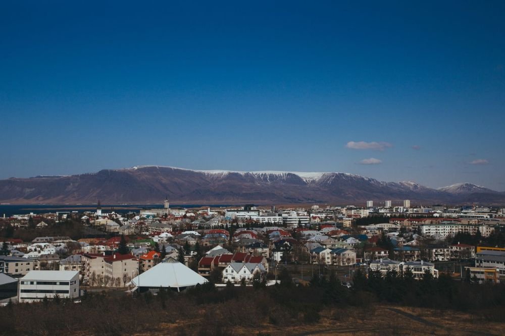
Reykjavik earns a place on this list more through geography and latitude than through raw centimetre totals. Iceland’s capital averages around 65 centimetres of annual snowfall meaningfully less than Stockholm or Bern but its position at 64 degrees north on a volcanic island in the North Atlantic creates a winter environment that those figures alone don’t fully capture.
The reason Reykjavik’s snowfall total is lower than its latitude would predict is the Gulf Stream. Iceland’s southern coast, where Reykjavik sits, receives enough oceanic warming to keep temperatures hovering around freezing for much of winter rather than dropping well below it. That means a significant portion of precipitation falls as rain or sleet rather than snow, and snowfall that does accumulate frequently melts between events. Ground cover is inconsistent in a way that Helsinki or Tromsø winters are not.
What Reykjavik has instead is wind. The city faces sustained gale-force winds from Atlantic systems multiple times per winter, and when those winds arrive simultaneously with snow, the conditions become severe very quickly regardless of how many centimetres are actually falling. Blowing snow reduces visibility to near zero, wind chill drives temperatures far below what the thermometer shows, and the combination creates genuine hazards that don’t show up in annual snowfall statistics.
Reykjavik’s school closure triggers reflect this reality. Wind and visibility conditions drive more closures than accumulation totals, and when Icelandic authorities issue weather warnings for the capital region, they’re typically responding to wind events, not snowfall in the conventional sense.
Snow season: November through March
Peak months: December through January
Closure risk: High
10. Warsaw, Poland
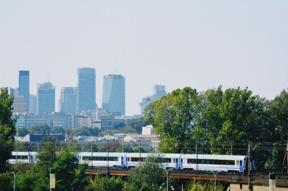
Warsaw closes out the list with 55 centimetres of annual snowfall, which makes it the most southerly and least dramatically snowy city in the ranking. But its inclusion matters because Warsaw is one of the largest cities in Europe — nearly 2 million residents — and its winter, particularly in the city’s coldest spells, brings conditions that the city’s central European latitude doesn’t always suggest.
Poland’s capital experiences a continental climate, which means cold winters without the oceanic moderation that softens Scandinavian coastal cities. When Siberian high-pressure systems push cold air westward into Central Europe — and they do, regularly, in January and February — Warsaw temperatures can drop to -20°C or below and stay there for days. At those temperatures, even modest snowfall accumulates in ways that cause serious disruption, because the cold prevents the natural melt that would normally reduce ground cover between events.
January is Warsaw’s snowiest month, with February close behind. The city averages 40 to 50 days of snow cover per season, though that figure varies considerably between mild winters with minimal accumulation and cold winters where ground cover persists from December through March without significant interruption.
Polish school closure culture sits somewhere between the strict Scandinavian approach and the more weather-reactive southern European pattern. Schools in Warsaw close for significant weather events, particularly those combining snow with extreme cold, but the city doesn’t shut down for a 10-centimetre snowfall the way cities in France or Italy might. Warsaw has known enough serious winters to have calibrated expectations.
Snow season: December through March
Peak months: January through February
Closure risk: Moderate
Europe Snowfall Comparison Table (All 10 Cities)
| # | City, Country | Annual Avg (cm / inches) | Peak Month | Snow Season | Closure Risk |
|---|---|---|---|---|---|
| 1 | Murmansk, Russia | 280 cm / 110″ | Nov–Jan | Oct–May | Very High |
| 2 | Innsbruck, Austria | 170 cm / 67″ | Jan–Feb | Nov–Apr | Very High |
| 3 | Tromsø, Norway | 150 cm / 59″ | Jan–Feb | Oct–Apr | Very High |
| 4 | Sarajevo, Bosnia | 140 cm / 55″ | Jan–Feb | Nov–Mar | Very High |
| 5 | Oslo, Norway | 130 cm / 51″ | January | Nov–Apr | High |
| 6 | Helsinki, Finland | 115 cm / 45″ | Jan–Feb | Nov–Apr | High |
| 7 | Stockholm, Sweden | 80 cm / 31″ | Dec–Jan | Nov–Mar | Moderate-High |
| 8 | Bern, Switzerland | 70 cm / 28″ | Jan–Feb | Dec–Mar | Moderate-High |
| 9 | Reykjavik, Iceland | 65 cm / 26″ | Dec–Jan | Nov–Mar | High |
| 10 | Warsaw, Poland | 55 cm / 22″ | January | Dec–Mar | Moderate |
How Do European Snow Days Compare to the US?
Worth knowing before you interpret these results: European snowfall thresholds for school closures are generally higher than in the United States, particularly compared to southern US states. A city like Warsaw or Stockholm will absorb snowfall totals that would close schools for a week in Atlanta or Charlotte.
The exception runs in the other direction too. Extreme cold — sustained temperatures below -20°C drives European closures in ways that have no real equivalent across most of the US outside of Alaska and the northernmost Great Plains states.
If you’re trying to predict whether school will close in a US or Canadian city during a winter storm, the snow day predictor runs your ZIP or postal code against real-time National Weather Service data and returns a probability based on your specific local conditions. It accounts for snowfall totals, temperature, wind, ice, and the timing of precipitation relative to the school bus window.
FAQ’s
Murmansk, Russia, with approximately 280 centimetres of annual snowfall. It is the world’s largest city north of the Arctic Circle and receives Arctic moisture from the Barents Sea throughout a seven-month snow season.
Among European capital cities, Oslo, Norway averages the most snowfall at approximately 130 centimetres annually. It is followed by Helsinki (Finland) at 115 centimetres and Reykjavik (Iceland) at around 65 centimetres. Sarajevo, Bosnia and Herzegovina, while not always included in capital city rankings, averages 140 centimetres and would rank above Oslo by that measure.
Murmansk and Tromsø both see their first measurable snowfall in October, and in some years, late September. Finnish Lapland cities north of Helsinki can also see early October snow in cold years. In the Alps, Innsbruck sees its first snowfall in November, though the surrounding mountain terrain above the city receives snow from October onward.
Yes, but less than many people expect given its northern latitude. Reykjavik averages around 65 centimetres of annual snowfall, and its maritime climate means snow frequently melts between events. The city’s most disruptive winter conditions come from wind rather than snowfall totals.
For reliable snow, Innsbruck and Tromsø are the strongest choices among cities with significant tourism infrastructure. Innsbruck offers Alpine scenery with direct access to ski terrain, while Tromsø provides Arctic winter experiences including northern lights, dog sledding, and polar night. Both cities have consistent snow seasons from November through April. For something less conventional, Sarajevo combines serious snowfall with significantly lower tourist density than either of those options.
Europe’s snowiest cities are significantly less snowy than the snowiest US cities. Murmansk at 280 centimetres (110 inches) would rank roughly in the middle of the top-10 US list. Marquette, Michigan, tops the US ranking at 297 centimetres (117 inches). The Great Lakes region’s lake-effect snow mechanism produces totals that few European cities match. Syracuse, New York (289 centimetres / 114 inches) and Erie, Pennsylvania (254 centimetres / 100 inches) both exceed Innsbruck’s annual average.
January is the peak snowfall month for most cities on this list, including Murmansk, Tromsø, Oslo, Helsinki, Stockholm, and Warsaw. Innsbruck and Sarajevo peak in January through February, while Bern and Reykjavik see their heaviest accumulation in December through January. Worcester, Massachusetts, among US cities, peaks in February later than most European counterparts because nor’easters draw moisture from the Atlantic well into late winter.